🌍 Flywave.gl


An open-source 3D map rendering engine built with TypeScript
Create high-performance, scalable 3D map visualization solutions using WebGL and Three.js
Quick Start · Documentation · Examples
Overview
flywave.gl is an open-source 3D map rendering engine built with TypeScript. This project adopts a modular monorepo architecture, aiming to provide a high-performance, scalable, and modular 3D map rendering solution.
You can use this engine to:
- 🌍 Develop visually appealing 3D maps - Create immersive map experiences using WebGL technology
- 🎨 Create highly animated and dynamic map visualizations - Based on the popular three.js library
- 🎨 Create themeable maps with dynamic switching - Support for multiple map styles and themes
- ⚡ Create smooth map experiences - Parallelize CPU-intensive tasks with Web Workers
- 🔧 Modular map design - Swap modules and data providers as needed
Screenshots
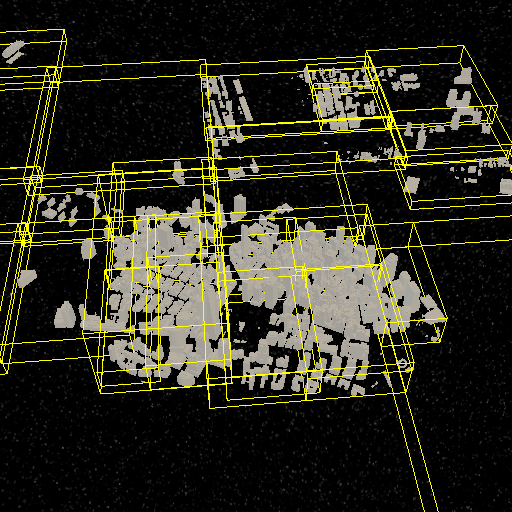 | 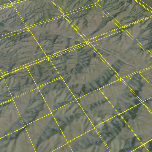 | 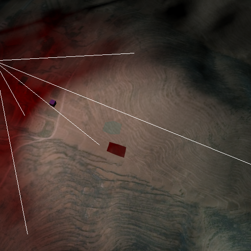 |
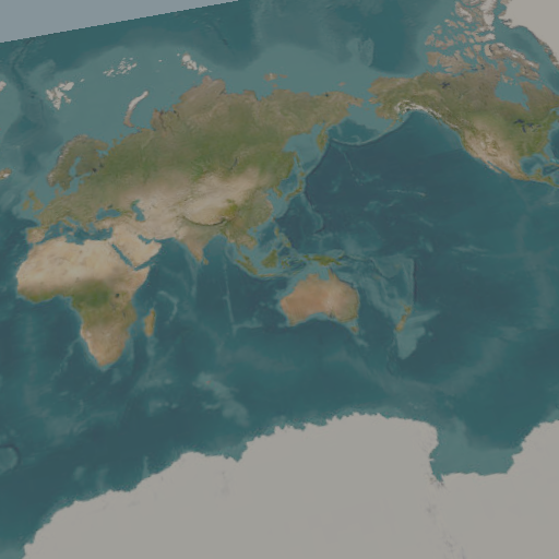 | 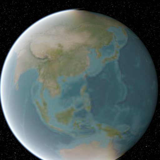 | 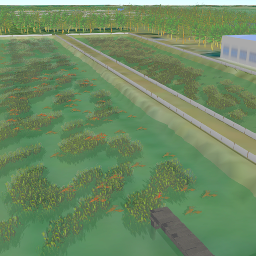 |
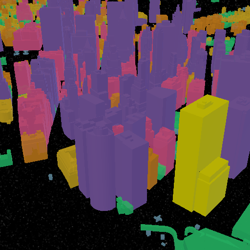 | 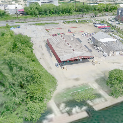 | 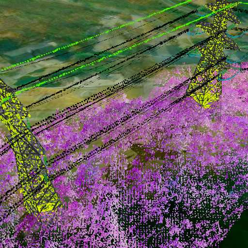 |
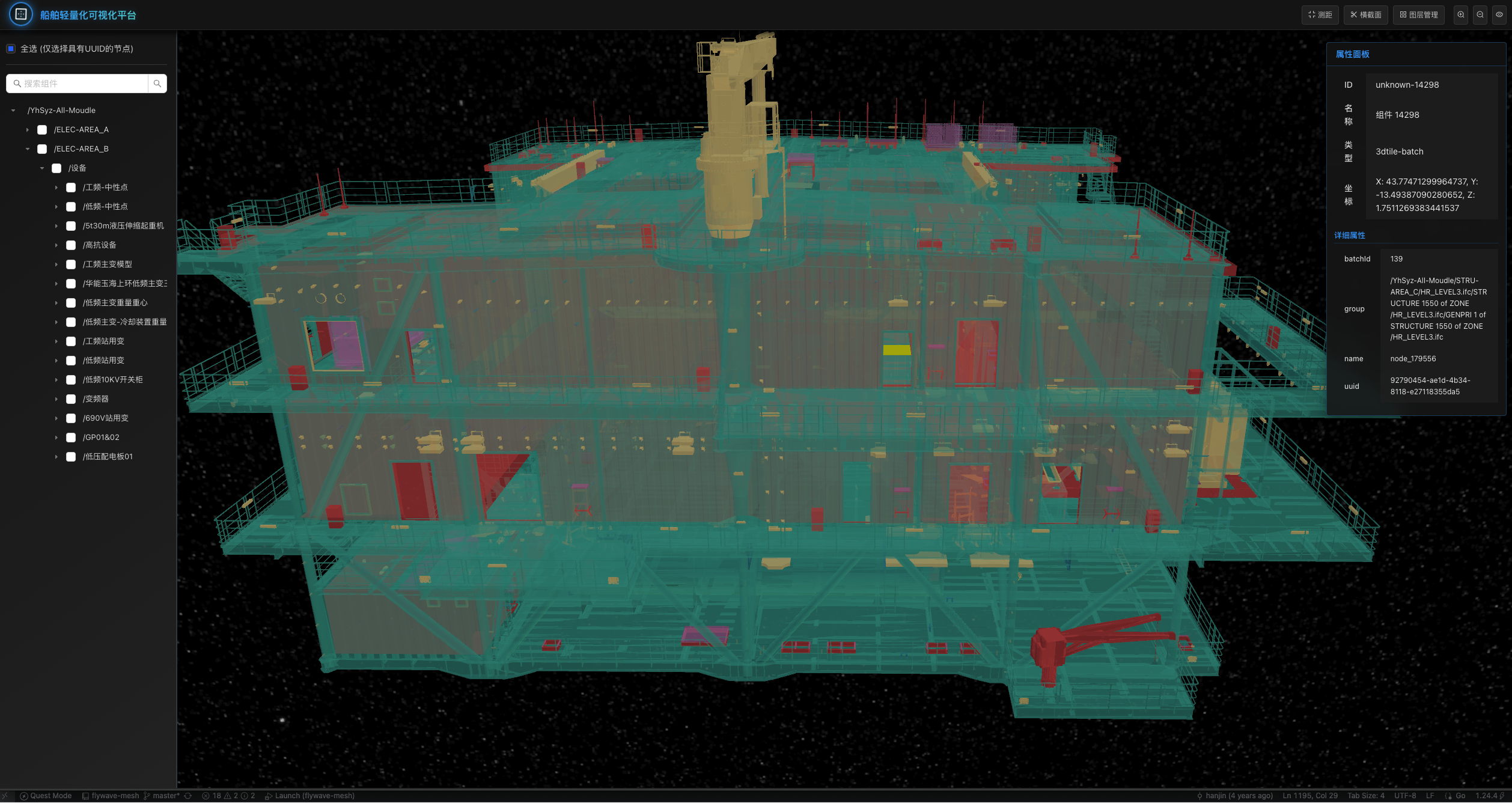 | 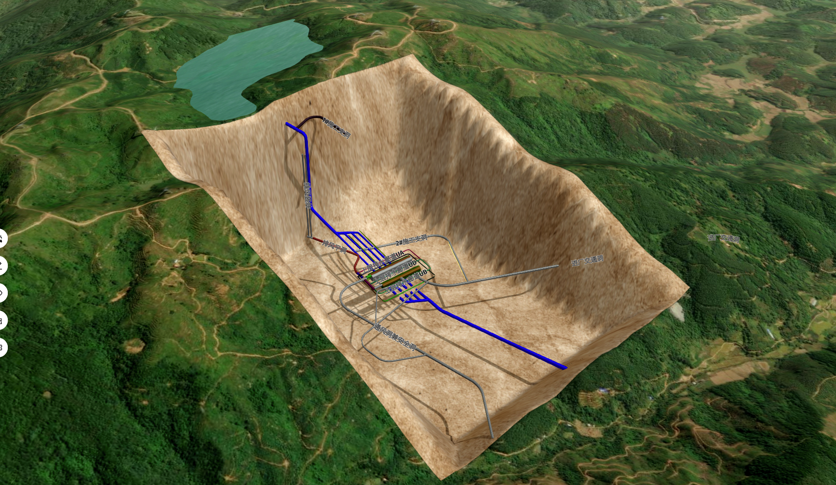 | 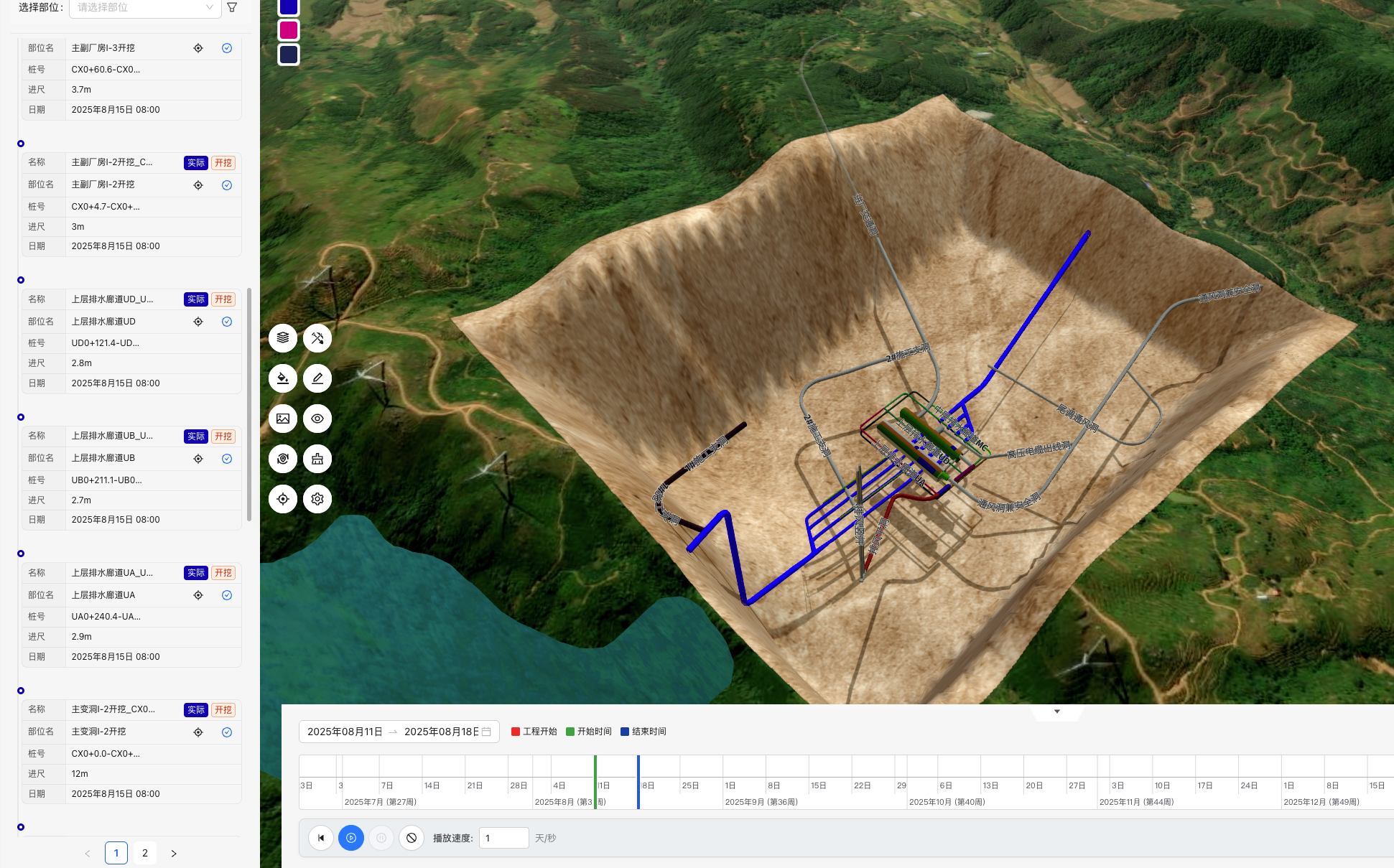 |
Documentation
- Complete Documentation - API docs, tutorials, best practices
- Example Collection - Feature examples, code snippets
- Development Guide - Environment setup, build instructions
- Quick Start - Installation, basic usage
- Issue Reporting - Bug reports, feature suggestions
- Community Discussion - Technical exchange, usage help
Quick Start
System Requirements
- Node.js >= 22.15.0 (Check with:
node --version) - pnpm >= 9.0.0 (Check with:
pnpm --version)
Installation
Using pnpm (recommended):
pnpm add @flywave/flywave.gl
Or using npm:
npm install @flywave/flywave.gl
Basic Usage
import { MapView, GeoCoordinates, sphereProjection } from "@flywave/flywave.gl";

const mapView = new MapView({
  projection: sphereProjection,
  target: new GeoCoordinates(36, 118),
  zoomLevel: 6,
  canvas: document.getElementById("mapCanvas") as HTMLCanvasElement
});
Core Features
- 🚀 High-performance rendering: Smooth 3D map rendering using WebGL and modern graphics technology
- 🔧 Modular design: Select and combine different functional modules as needed
- 🎨 Extensible themes: Support for dynamic switching and custom map themes
- 🗺️ Multi-data source support: Support for various map data source formats
- 🖱️ Rich interaction features: Complete map interaction and control functionality
- 🌍 Multiple projection methods: Support for spherical, planar, and ellipsoidal projections
- 🏔️ Terrain support: Built-in Digital Elevation Model (DEM) support
License
Copyright © 2022-2025 Flywave Project Authors
Licensed under the Apache License, Version 2.0.